


In the hills once known primarily as the site of Kathmandu’s garbage dump, a remarkable transformation is underway, driven by the innovative efforts of a Nepali drone technology startup, Geovation Nepal Pvt. Ltd. This company has turned Banchare Danda from a contested and polluted landfill area into a pioneering example of how modern drone technology can solve complex environmental, logistical, and societal challenges.
From Conflict to Innovation: The Banchare Danda Story
Banchare Danda, located near Kathmandu, was long associated with waste disposal struggles. The existing landfill site at Sisdole in Okharpauwa, Nuwakot, had reached capacity, and efforts to establish a new long-term waste facility at Banchare Danda faced delays and strong local opposition due to environmental pollution and foul odors. Traditional ground surveying methods were halted by protests, making it difficult to assess the site properly.
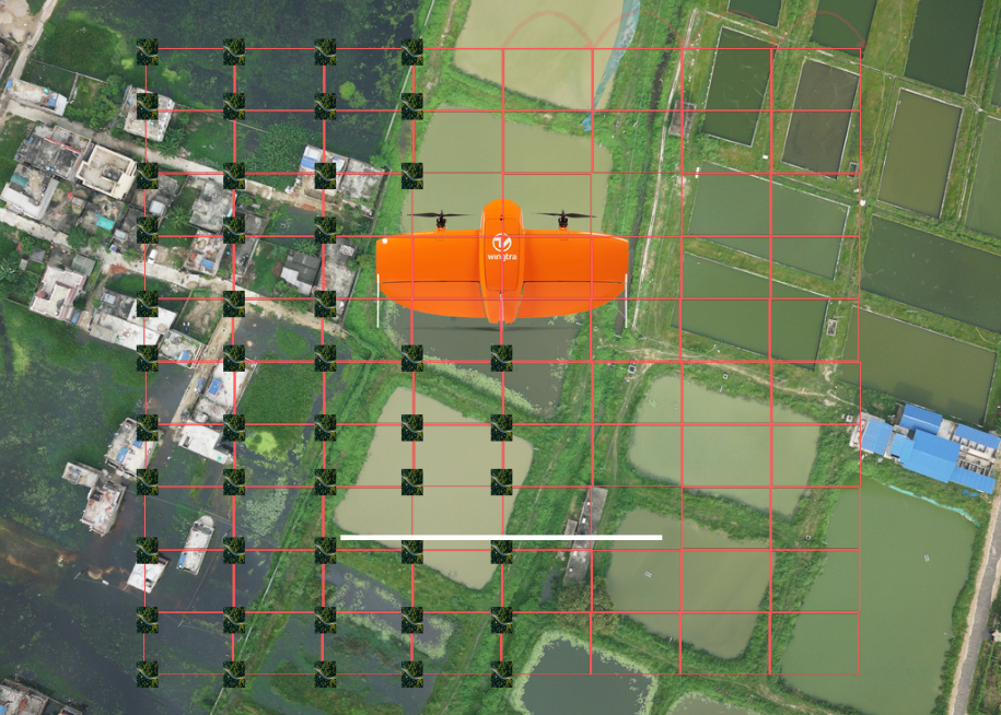
Geovation Nepal stepped in with a drone-based solution, conducting high-resolution aerial mapping of the disputed landfill without disturbing the land or residents. This approach provided precise topographical data remotely, enabling authorities to better understand the terrain and plan accordingly without physical intrusion. This breakthrough marked a turning point for both the site and the startup, showcasing the power of drones in overcoming logistical and social barriers.
Founding Vision and Growth
Founded in January 2021 by a group of engineers and environmental enthusiasts—Kumar Paudel, Deepa Lamsal, Prabin Lamsal, Upendra Oli, Prabin Rana, and Kshitija Jaspaul—Geovation Nepal began with the mission to simplify complex land surveying through unmanned aerial vehicles (UAVs), commonly known as drones. Starting with an initial investment of NPR 2.5 million (approximately USD 19,000), the company quickly grew to a valuation of NPR 20 million (USD 150,000) and generates annual revenues nearing NPR 15 million. The 12-member team combines expertise in geomatics, data science, environmental analysis, and software development to deliver tailored drone services from their base in Baluwatar, Kathmandu.
Expanding Horizons: Diverse Applications of Drone Technology
Geovation Nepal’s services have expanded far beyond land surveying. Their drone fleet, equipped with fixed-wing, multi-rotor, VTOL, thermal imaging, and multispectral sensors, supports a wide array of sectors:
-
Urban Planning and Infrastructure: Providing detailed mapping and monitoring for roads, housing, irrigation systems, and construction projects.
-
Wildlife and Ecological Monitoring: Tracking species such as the Himalayan blue sheep (Naur), gharials, rhinos, and the elusive red panda, aiding conservation efforts.
-
Disaster Risk Management: Offering rapid aerial assessments during floods, landslides, and other natural disasters to improve emergency response.
-
Precision Agriculture: Using sensors to analyze soil health, water saturation, and crop diseases, with plans to introduce drone spraying for fertilizers and pesticides.
-
Environmental Conservation: Mapping habitats and monitoring ecological changes to support sustainable development.
These projects often involve collaboration with government bodies like the Investment Board of Nepal, local municipalities, federal departments, and international organizations such as the World Bank, Asian Development Bank, and World Wildlife Fund (WWF).
Advantages Over Traditional Surveying Methods
Nepal’s rugged terrain makes conventional surveying difficult, time-consuming, and risky. Surveyors often spend weeks trekking through mountains and forests carrying heavy equipment. In contrast, Geovation Nepal’s drones can cover up to 200 hectares in a single day, collecting precise data without endangering personnel. While data processing still requires time, the overall speed and safety benefits are significant.
Co-founder Prabin Lamsal emphasizes, “A drone can do in days what would take a month on foot — and without risking lives.” This efficiency has made drones the preferred choice for surveying and mapping in Nepal’s challenging geography.
Navigating Regulatory and Cost Challenges
Government agencies are Geovation Nepal’s primary clients, relying on their drone services for infrastructure development and disaster preparedness. However, drone operations require permissions: small drones need district-level approval, while larger ones require clearance from the Ministry of Home Affairs, a process that can take from a week to a month.
Initially, drones were viewed with suspicion, often mistaken for security threats or toys. Over time, increased understanding within government agencies has smoothed the approval process, facilitating wider adoption.
Despite their advantages, drones are costly. Geovation Nepal’s fleet includes advanced models costing up to NPR 10 million (about USD 75,000), plus expensive sensors like LiDAR and specialized cameras, and software licenses. The company stresses that the technology and skilled manpower behind drone operations justify the investment, as the precision and safety they offer are often undervalued.
Pioneering Precision Agriculture and Disaster Response
Geovation Nepal is pioneering the use of drones in precision agriculture, helping farmers make data-driven decisions by assessing soil conditions, water levels, and crop health from the air. Plans to deploy spraying drones for automatic fertilizer and pesticide application could revolutionize sustainable farming in Nepal.
In disaster management, drones hold untapped potential. For example, during the 2023 floods in Bagmati Province, drones could have been deployed to locate stranded victims and deliver emergency supplies before rescue teams arrived. The company envisions drones monitoring glacial lakes, forecasting flood risks, and assisting insurance companies in rapid damage assessment. They also see applications in hydropower project inspections to reduce downtime and improve safety.
Training and Capacity Building
Beyond service delivery, Geovation Nepal invests in training. They have equipped Nepal Police and local organizations with drone operation skills for emergency response. NGOs and cooperatives also learn to use drone data for environmental monitoring and community planning, building local capacity for sustainable development.
Recognition and Future Plans
Geovation Nepal was a finalist in the ICT Startup Awards 2024, highlighting its innovative approach and national impact. Looking ahead, the company aims to double its client base to 25 agencies annually and continue pioneering new drone applications across Nepal and beyond.
Quick Facts: Geovation Nepal Pvt. Ltd.
| Detail | Information |
|---|---|
| Founded | January 4, 2021 |
| Headquarters | Baluwatar, Kathmandu, Nepal |
| Initial Investment | NPR 2.5 million (~USD 19,000) |
| Current Valuation | NPR 20 million (~USD 150,000) |
| Annual Revenue | NPR 15 million |
| Employees | 12 |
| Major Clients | 15+ government & international agencies |
| Core Services | Drone surveying, mapping, conservation, disaster response, agriculture |
| Recognition | ICT Startup Award Finalist 2024 |
| Key Goal | Expand to 25 annual agency clients |
Geovation Nepal’s journey from addressing a local landfill dispute to becoming a leader in drone-based geospatial technology exemplifies how innovation can transform environmental and developmental challenges. With its cutting-edge technology, expert team, and collaborative approach, the company is charting a new course for Nepal’s sustainable future.

Nepaliict
- iPhone 17 Nepal Launch: Price, Features & Availability Guide 2025
- AI Chatbots Being Used to Create Dangerous Email Scams Targeting Elderly People
- How to Turn Off Autoplay on Your Social Media Feeds: Complete Platform Guide
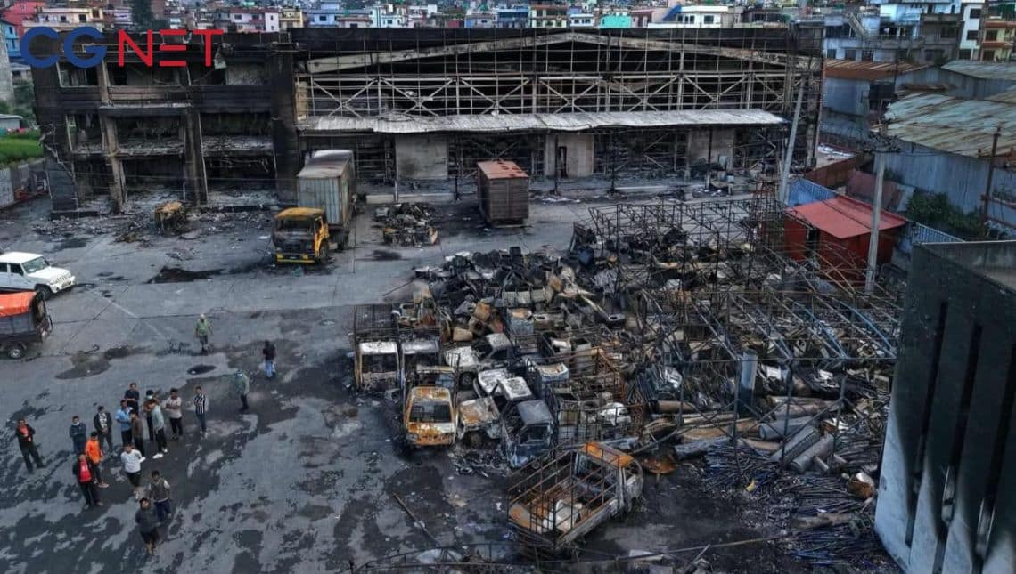
- CG Net Data Center Destroyed by Arson Attack: Internet Services Gradually Resuming
- Hukut Store Launches Exciting ‘Spin and Win’ Dashain Offer: Win Scooters to iPhone 17


Comments